Hanoi's 2050 Master Plan Approved
Fri, 10 Jan 2025 16:13:00 | Print | Email Share:
The Hanoi Capital Plan 2021-2030, with a vision to 2050, marks an important step in addressing the city's bottlenecks and difficulties.

Hanoi aims to develop a "civilized, modern, and green" smart capital, on par with leading capitals worldwide
On December 12, Prime Minister Pham Minh Chinh signed Decision 1569/QD-TTg on ratification of the Hanoi Capital Planning for the period 2021-2030, with a vision to 2050. The total planned natural area is 3,359.84 square kilometers.
Central metropolis with the Red River as a landscape axis
The Hanoi Capital Planning is built with a “new vision - new global thinking, Capital thinking and Hanoi action” to create “new opportunities - new values” to develop the “civilized - modern” Capital in the short and long terms and give a helping hand to lead the country into a new era, the era of rising Vietnamese people.
The core view of the planning is “people-centric development”, with the image of Hanoi shaped as “Cultured Capital - elegant and splendid global connection - harmonious development - peaceful prosperity - enabling government - devoted business - confident society - happy people”.
The planning sets out five general development views, in which the Capital development is consistent with the country’s socioeconomic development strategy, with the national master plan and the Red River Delta regional planning. The planning also arouses the aspiration of developing a “civilized - modern - civilized” green, smart Capital on par with the capitals of developed countries in the region and the world.
Spatially, Hanoi is arranged and distributed with an economic and social development space according to the center-line structure comprised of economic corridors, economic belts and development axes, along with a synchronous transport infrastructure system for socioeconomic development, regional, national and international connectivity, with the close linkage of industrialization and modernization with urbanization, and with harmonious urban and rural development.
The Capital will effectively and harmoniously develop and exploit five spaces: Public space, overhead space, underground space, cultural - creative space, and digital space.
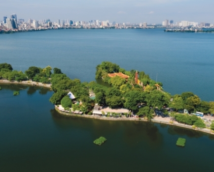
The Red River is the green axis and the central landscape axis of the Capital, a space of cultural heritage, tourism and services. It connects the Capital Region and the Red River Delta.
Urban space is developed according to the core-satellite model which embraces central urban areas and cities in the Capital, satellite cities and ecological towns. Hanoi will develop new urban models by specific functions like Transit-oriented urban development (TOD), science and technology urban areas, airport urban areas and tourism urban areas.
Rural area development is aligned with urbanization, economic development, cultural identity preservation, natural landscape protection and the environment. Modern living conditions are facilitated while typical traditional features are maintained, and natural landscape values and cultural and historical values are preserved and promoted.
The Hanoi Capital Planning sets out five key tasks: Environmental and landscape protection, urban and rural development, economic development, cultural-social development, and sci-tech development and innovation.
It also states four breakthrough stages: Institutions and governance; synchronous, modern and connected infrastructure; Development of high-quality human resources, science and technology and humanistic resources; and urban, environment and landscape.
Five development spaces defined
Socioeconomic activities in the Hanoi Capital Planning are organized by the following model: Five development spaces - five economic corridors and belts - five development driving axes - five economic and social regions - five urban regions
Five development spaces include overhead space, underground space, public space, creative cultural space, and digital space.
The economic corridors and belts are formed on the basis of economic corridors devised in the National Master Plan.
Five development driving axes include Red River axis, West Lake-Co Loa axis, Nhat Tan-Noi Bai axis, West Lake-Ba Vi axis, and the Southern axis.
Five socioeconomic regions are composed of the central region (including the historical quarters, the central urban area and the expanded central urban area in the south of the Red River), the eastern region, the southern region, the western region, and northern region.
Five developed urban areas include the central urban area, the western urban area, the northern urban area, the southern urban area, and the Son Tay-Ba Vi urban area.
By: Nguyen Mai, Vietnam Business Forum
Source: https://vccinews.com/news/59855/hanoi-s-2050-master-plan-approved.html
---------------------------------------------
Same category News :


